About the Rahway River
Encompassing 130 square miles, the Rahway River watershed is one of the oldest urbanized areas of the State of New Jersey stretching from Edison Township in Middlesex County north to the Oranges of Essex County and westward to the Watchung Ridges. Despite the man made landscape that predominates the region, nature remains resilient with oases of wildlife and remarkable natural areas tucked in pockets along the various branches of the Rahway River. For these reasons, the Rahway River Association has been the region’s leading voice in championing the cause of preserving open space, improving water quality and protecting natural resources of the Rahway river watershed since 1992.
The Rahway River is 24 miles long and drains a land area of 41
square miles of Essex, Middlesex and Union counties.
There are 24 municipalities in the Rahway River watershed including
Maplewood, Millburn, South Orange and West Orange in Essex County,
Carteret and Edison in Middlesex County and Cranford, Mountainside,
Springfield and Rahway in Union County.
The Rahway River consists of four distinct branches. The West
Branch, begins in Verona and flows south through South Mountain
Reservation and directly through downtown Millburn. The East Branch
originates between West Orange and Montclair and travels South
Orange and Maplewood. These two branches converge near Route 78 in
Springfield and flow through Clark, Cranford and Union. In Rahway,
the confluence of the Robinson’s and the South Branches of the river
occurs. The river continues through Linden and Carteret forming the
boundary between Middlesex and Union counties and drains into the
Arthur Kill.
The Rahway River is the source of drinking water for the 26,500
people in the City of Rahway.
Portions of the Rahway River are part of the East Coast Greenway, a
2,600 mile trail between Maine and Florida.
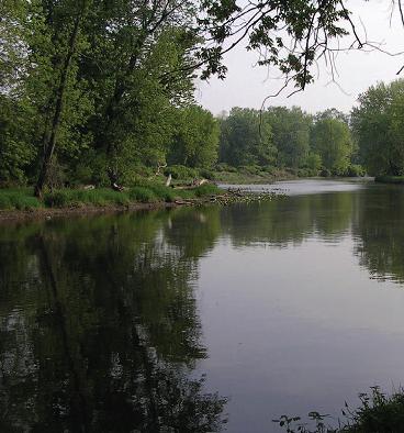
There is close to 5,000 acres of county parkland in the Rahway River
watershed. Much of the Rahway River corridor in Essex and Union
counties is public open space.
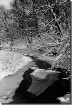
The lower Rahway River is tidal. The tidal portion of the river
extends up into the City of Rahway. The upper portion of river
corridor consists of floodplains, woodlands and freshwater wetlands
while the lower portion consists of salt marshes and tidal flats.
The Rahway River watershed was the site of several Revolutionary War
battles and engagements. Most notable among them were the Battle of
Short Hills 1777 and in 1780 the Battle of Connecticut Farms in
Union and the Battle of Springfield. There are many National
Historic Sites associated with the American Revolution in the Rahway
River watershed.
The Rahway River is home to four anadromous fish species (fish that
spawn in freshwater and live in saltwater) and one species of
catadromous fish species (fish that spawn in salt water and live in
freshwater). There are plans to install a fish ladder at the Rahway
City Water Works to aid these fish during their spawning migrations.
Portions of the Rahway River are stocked with trout by the New
Jersey Department of Environmental Protection.
The Rahway River’s woodlands and wetlands provide much needed
wildlife habitat in the region. Bio Blitzes (a 24 hour biological
inventory) conducted in 2005 and 2006 each documented the presence
of nearly 700 species of plants and animals.